Incorporating MAVES - Registered Charity no. 1180078

Wildlife Surveys
Experienced Biodiversity Recorders eg in Botany, Birds, Invertebrates, Amphibians, Mammals, and other environmental historians, are invited to contact Jackie Thompson via the email address on the Contact page. We need your help in this area, including on private land where MAVES has been given permission by the landowner.
Records are continually being added but some of the principal reports we have commissioned can be read on the links below.
2019
2018
MAVES Ecological Survey Report "The Mid Arun Valley - 2018 Update"
Dan Whitby's 2018 Bat Trapping Survey Report for MAVES
2017
December 2017: The MAVES Ecological Survey Report
- Two years of Data Collecting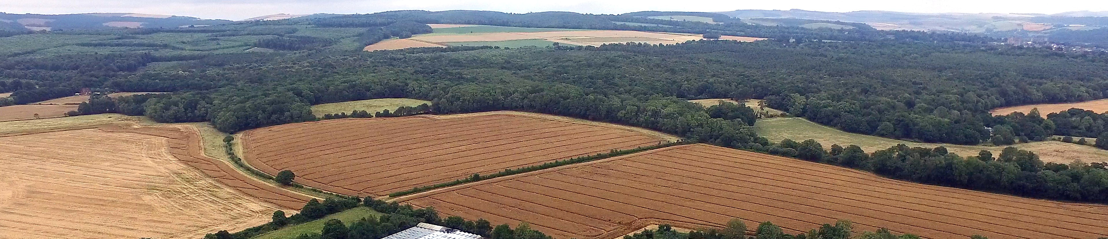
MAVES Entomological Survey Report 2016-17
by Mike Edwards, Graeme Lyons, Peter Hodge
(A higher res version can be read here)
October 2017: A27 route Options Impact Comparison Table
= summary of key impacts, supplementing the Oct 2017
consultation response to Highways England
October 2017: Full Ecological Impact Report on A27 options 1,3,5A
= Consultation response to Highways England
Dan Whitby's July 2017 Bat Survey Report for MAVES
April/June 2017 ecological survey report on Stewards Copse
March 2017: Supplement to Oct 2016 Maves Ecological Survey report
2016
October 2016: Maves Ecological Survey report
Dan Whitby's 2016 Bat Survey report for Maves
Dr Katherine Grove's 2016 Beetles of Binsted survey report
Mike Edwards' DRAFT 2016 Entomological survey report
2015
2015 MAVES Survey Results Summary
Before 2015
The Beetles of Binsted Woods 2006 Dr Katherine Grove
What's the Scope of MAVES' Ecological Surveys?
The Arun Valley south and West of Arundel, its meadows, tributaries and surrounding woods and farmland, around the villages of Binsted and Tortington and across to Lyminster, offers a rich oasis of tranquil habitats amid the bustle of the Coastal Plain. Surprisingly its ecology has not up to now been extensively surveyed.
MAVES aims to gather, interpret and make appropriately accessible existing and new ecological data for the area. The information will be available in the public domain as a valuable history and record for use by local communities, educational projects, landowners and farmers.
Eight sectors have been identified for search – see overview map on the Home Page. These sectors have been chosen to take into account size and complexity (so a more uniform habitat can cover a larger area). Each sector is distinguished by land use, habitat types, elevation and orientation. We are grateful for the survey permissions already given by many landowners and occupiers.
- Sector 1 Hundred House – Sussex Wildlife Trust SWT managed ancient woodland Nature Reserve plus surrounds.Important links to woodland and fields in Sectors 3,5,2.
- Sector 2 Binsted Rife - Grazing marsh and adjacent fields.
- Sector 3 North Binsted - from Church Farmhouse to Binsted Woods, consisting of mixed field sizes around and within the ancient woodland edge.
- Sector 4 South Binsted - from Muddy Lane to Marsh Farmhouse consisting of fields with old hedges, woodland and streams
- Sector 5 Main Woodland Area - including parts of Rewell Wood, Binsted Wood and Tortington Common
- Sector 6 South Tortington - Variety of field sizes with trees, hedges, streams and then grazing marsh down to the Arun
- Sector 7 North Tortington - Variety of field sizes with trees and hedges, eastwards to the Arun
- Sector 8 River Arun and Wet Meadows - From the River to the built up areas of Lyminster and Wick.
Evidence based reports are being produced to include the following:
1) An ecological description of the Habitats in the area including comment on their status and importance (for example including any local and national designations and notes on priority habitats under the UK Biodiversity Action Plan.
2) An audit of Species present in the area, including as many species groups as possible that are appropriate to the habitats present. This will include new or recent species records and historic records as available, with an interpretation of the importance of key species, and comments on the range of species diversity in the areas.
3) A commentary to evaluate and interpret the findings as regards Habitats and Species, which should where appropriate indicate:
- any wider significance of the Habitats and Species in the context of government policies.
- how an ecological description of the area under consideration links to the Special Qualities of the South Downs National Park and its surroundings, as articulated in the South Downs National Park Authority’s “State of the South Downs National Park, 2012”.
- any historic or cultural heritage importance of the Habitat areas.
Sensitive species data will be handled with appropriate confidentiality, for example by using generalized location information.
Survey Data
Our consultant ecologist Jackie Thompson has carried out a Phase 1 Habitat Survey as a scoping exercise to help direct future more detailed surveys.
Our volunteer or commissioned expert surveyors are carrying out surveys whenever they have the time, the time is right for the species, and it is not an inconvenient time for the landowner or occupier.
Early findings in 2015 and 2016 included a field with 500 orchids in it of two different species; other flowers more locally scarce such as bitter vetch and cow-wheat; a growing understanding of the local population of dormice; the exciting confirmation that water voles are still present in these Rifes; and the discovery, in just one night's survey in the western Binsted Woods area, of 13 species of bats including Bechstein's, Barbastelle and Alcathoe.
In order to protect wildlife and landowners from inappropriate interest in sensitive sites, survey data published on this site will not be specific as to location.
